
R&R SERVICES
APPLYING PRINCIPLES + PRACTICES
Whether it’s completing a survey to meet a closing date or expediting the approval process, we combine experience and technology to deliver cost and time efficiencies.
LAND SURVEYING SERVICES
-
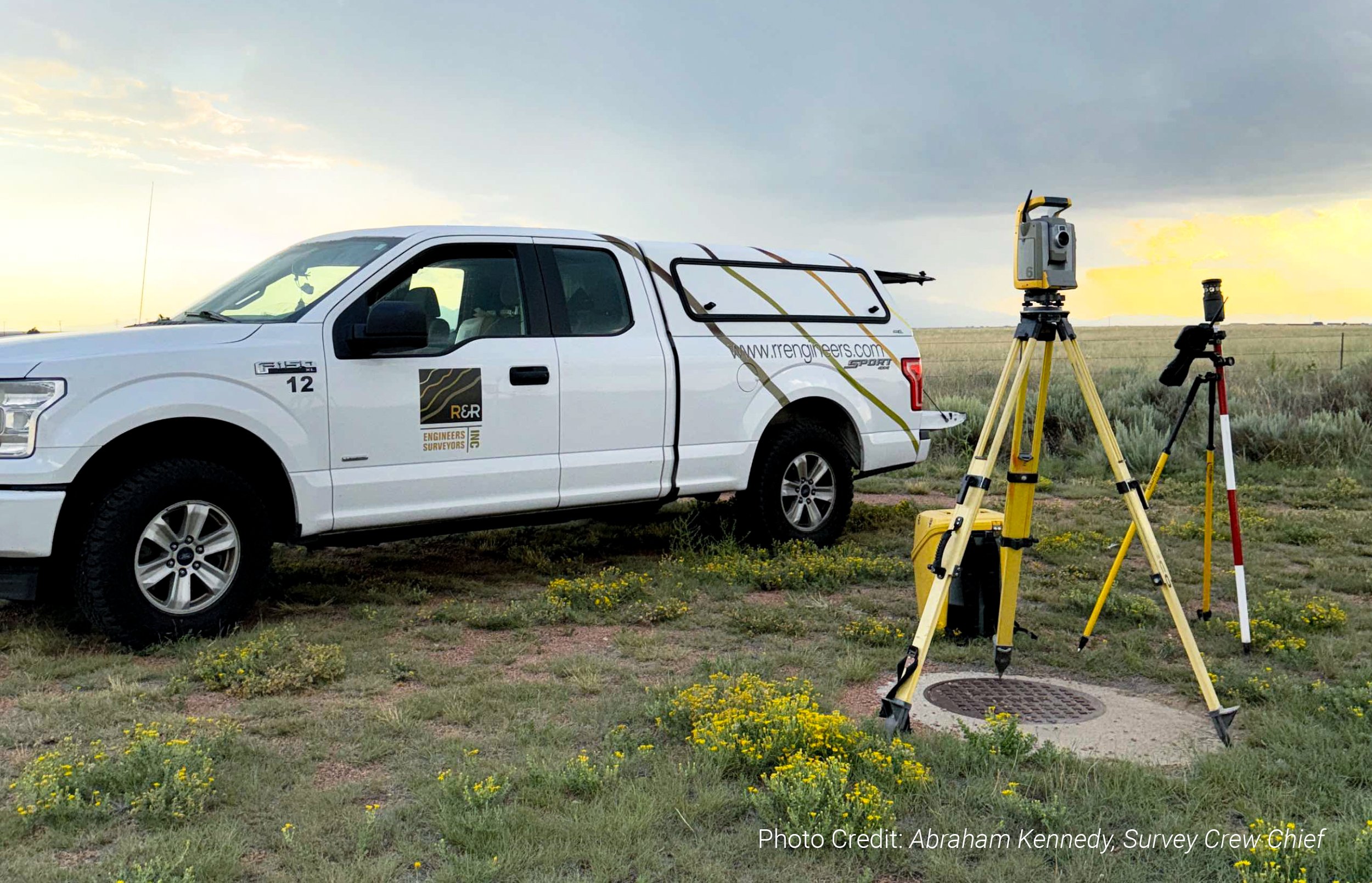
3D Laser Scanning: R&R utilizes the Trimble X7 for high-definition imaging and 3D laser scanning. This creates a 3D point cloud data set that can be analyzed and processed in a variety of design software including AutoCAD, Revit, and BIM. The Trimble X7 provides an innovative and versatile approach allowing our clients to save time and money on every project.
Aerial Photogrammetry: Photogrammetry is the science and technology of using photographs to capture accurate measurements and 3D data about objects, surfaces, and environments. It analyzes image geometry and spatial properties to create detailed 3D models and maps. Our DJI MAVIC 3 DRONE is a powerful 2 lb aerial photogrammetry tool with a Hasselblad 20MP camera, a range for large sites, and a 40–46 minute flight time (wind-dependent).
Benefits of using aerial photogrammetry include:
Measures distances, angles, and heights.
Creates topographic and elevation map
Tracks landscape changes over time.
-
We specialize in surveying and staking for energy projects, from wind and solar farms to traditional utilities. Our services map topography, boundaries, easements, and environmental factors while providing precise construction staking to ensure accuracy and regulatory compliance.
Using advanced technology like 3D scanning and GPS, we deliver reliable solutions for energy infrastructure, keeping your project on time, on budget, and aligned with industry standards. Trust R&R Engineers-Surveyors, Inc. to power your vision with tailored expertise.
-
R&R provides precise Utility and Right of Way (ROW) surveys critical for construction success. Our Utility Surveys map underground lines—water, gas, electric, and telecom—ensuring safe planning and regulatory compliance.
ROW Surveys define property boundaries, easements, and zoning alignment for seamless development. With clear communication and tailored solutions, we support your project's success from start to finish.
-
Construction layout is a critical step in every project. Also called construction staking, it establishes property boundaries and creates a coordinate system to guide civil, architectural, and structural plans. R&R reviews staking documents to design layouts for foundations, roads, sidewalks, and utilities. Field crews use these plans to align site features both horizontally and vertically. Survey stakes serve as reference points for accurate project completion. Afterward, construction surveyors provide as-builts to confirm the project meets design plans and local regulations.
-
An ALTA/NSPS Land Title Survey is a detailed land survey adhering to standards set by the American Land Title Association (ALTA) and the National Society of Professional Surveyors (NSPS). Typically requested by lenders and title companies during commercial property transactions, these surveys go beyond standard boundary surveys, detailing buildings, utilities, fences, easements, encroachments, and other factors affecting property value or use. They often involve collaboration with engineers and attorneys ensuring all relevant information is included in the survey.
-
Topographic and design surveys are essential tools for successful development, providing critical data about a site’s physical features and ensuring projects are safe, efficient, and harmoniously integrated into their surroundings.
Topographic surveys capture detailed information about a site's natural and man-made features, including hills, valleys, rivers, and buildings. Using advanced equipment, surveyors measure land elevation, contours, and slopes to create accurate maps that serve as the foundation for structural design and planning.
Design surveys focus on the specific needs and requirements of a proposed development. They account for factors such as the structure's size, shape, materials, and environmental conditions. Often conducted after a topographic survey, design surveys rely on this foundational data to refine and optimize project plans.
-
Bathymetric surveying maps underwater topography in lakes, rivers, or oceans, detailing depths, floor shapes, and underwater obstructions like rocks or shipwrecks. Using sonar or acoustic depth finders, sound waves are sent and measured to calculate depths and create detailed maps.
Applications include navigation, marine exploration, and ecosystem research. In the shipping industry, bathymetric surveys are crucial for avoiding hazards and ensuring safe navigation.
-
Platting and boundary surveys establish property boundaries and create accurate maps for real estate and land development. Both surveys verify accurate real estate transactions, clear property understanding, and safe, efficient construction.
Boundary Surveys determine legal property lines, corners, easements, setbacks, and rights of way using field measurements and historical records. The results provide a legal property description for transactions and disputes.
Platting Surveys map property features like buildings and roads, often for subdivisions or large developments. They detail boundaries, easements, and rights of way.
-
R&R Engineers-Surveyors, Inc. ensures precise mapping by integrating advanced technologies and methodologies into our surveying processes. We utilize the Trimble X7 for high-definition 3D laser scanning, capturing detailed point cloud data that can be processed in design software like AutoCAD, Revit, and BIM.
Our DJI Mavic 3 drone is equipped with a Hasselblad 20MP camera, enables aerial photogrammetry to accurately map large sites. These tools, combined with our team's expertise, allow us to deliver accurate and efficient mapping solutions tailored to your project's needs.


CIVIL ENGINEERING SERVICES
-
R&R Engineers-Surveyors, Inc. specializes in designing efficient and sustainable water, sanitary, and storm sewer systems with a focus on reliability, efficiency, and environmental stewardship. Services include designing potable and non-potable water systems, creating sanitary sewer systems to meet municipal standards, managing runoff through storm sewer design, coordinating utilities with existing systems, and optimizing performance with hydraulic and hydrologic analysis.
-
R&R Engineers-Surveyors, Inc. offers expert Hydrology & Water Resources services to tackle water management challenges and promote sustainable site development. Our services include hydrologic modeling to analyze rainfall, runoff, and watershed dynamics; stormwater management systems, such as detention basins and low-impact features; floodplain analysis to assess flood risks and ensure FEMA compliance; water supply design optimized for potable, irrigation, and industrial use; and erosion control measures to protect soil and water quality.
-
R&R Engineers-Surveyors, Inc. provides specialized Subsurface Utility Engineering (SUE) services to identify, map, and manage underground utilities, ensuring efficient and conflict-free project development. Using advanced technology, our team delivers reliable data to reduce risks and delays. Services include utility designation to locate subsurface utilities, precise utility mapping for project planning, conflict analysis to resolve potential issues, and utility coordination to streamline relocations or adjustments.
-
R&R Engineers-Surveyors, Inc. delivers expert Transportation Engineering and Street Design services for efficient, safe, and sustainable mobility. We specialize in roadway design, intersection optimization, pedestrian and bicycle infrastructure, parking lot planning, and stormwater integration. Collaborating with municipalities and developers, we create functional, compliant, and innovative solutions that enhance community connectivity and support lasting mobility improvements.
-
R&R Engineers-Surveyors, Inc. provides comprehensive due diligence services to support site development decisions. Our civil engineering team evaluates key factors like:
Site Analysis: Topography, soil, floodplain impacts, and easements.
Regulatory Review: Zoning, land use, and permitting compliance.
Infrastructure Assessment: Utilities, access, drainage, and more.
Environmental Review: Wetlands, habitats, species, and stormwater concerns.
We mitigate risks, streamline approvals, and deliver actionable insights, ensuring your project is built on a solid foundation of accuracy and compliance.
-
R&R Engineers-Surveyors, Inc. simplifies the land use approval process with expert Entitlement Support services, ensuring project viability and compliance. Our services include:
Zoning & Land Use Analysis: Aligning projects with zoning and land use policies.
Entitlement Applications: Preparing and submitting rezoning, subdivision, and site plan requests.
Agency Coordination: Collaborating with governing bodies to secure approvals.
Public Hearing Representation: Providing expert advocacy at hearings and meetings.
Compliance Review: Ensuring adherence to codes, standards, and regulations.
We deliver thorough analyses, clear documentation, and expert guidance to overcome regulatory challenges efficiently and achieve successful project approvals.
-
R&R Engineers-Surveyors, Inc. specializes in Grading & Earthwork Analysis services for efficient site development and compliance with design requirements. Our civil engineering team delivers precise evaluations and solutions tailored to the unique topographical and soil conditions of each project site, streamlining the construction process and reducing unexpected challenges.
Services include:
Site Grading Design: Optimize drainage, infrastructure, and building layouts.
Earthwork Quantification: Balance cut-and-fill volumes to reduce costs and environmental impact.
Erosion Control Planning: Prevent site degradation and protect surrounding areas.
Drainage Integration: Coordinate grading with stormwater systems to manage runoff effectively.
-
R&R Engineers-Surveyors, Inc. specializes in designing and evaluating Detention and Water Quality Facilities for efficient stormwater management and regulatory compliance. For each project, our civil engineering team addresses site-specific hydrological needs. Services include designing detention basins to control runoff and prevent flooding, water quality systems to meet standards, hydrologic and hydraulic analysis for optimal performance, erosion control to protect water quality, and ensuring designs meet all permitting requirements.
-
To optimize land use, compliance, and streamline project execution, R&R Engineers-Surveyors, Inc. utilizes our expertise to deliver thoughtful solutions, meeting each site's unique needs. What we offer:
Feasibility Studies: Evaluate site suitability, infrastructure, and constraints for development viability.
Conceptual Design: Design layouts for land use, utilities, parking, and stormwater management.
Environmental Analysis: Address drainage, floodplain impacts, and soil conditions.
Infrastructure Planning: Identify utility connections and roadway needs.
Regulatory Review: Adhere to compliance with zoning and jurisdictional standards.


OWNER’S REPRESENTATIVE SERVICES
-
R&R Engineers-Surveyors, Inc. specializes in designing efficient and sustainable water, sanitary, and storm sewer systems with a focus on reliability, efficiency, and environmental stewardship. Services include designing potable and non-potable water systems, creating sanitary sewer systems to meet municipal standards, managing runoff through storm sewer design, coordinating utilities with existing systems, and optimizing performance with hydraulic and hydrologic analysis.
-
R&R Engineers-Surveyors, Inc. offers expert Hydrology & Water Resources services to tackle water management challenges and promote sustainable site development. Our services include hydrologic modeling to analyze rainfall, runoff, and watershed dynamics; stormwater management systems, such as detention basins and low-impact features; floodplain analysis to assess flood risks and ensure FEMA compliance; water supply design optimized for potable, irrigation, and industrial use; and erosion control measures to protect soil and water quality.
-
R&R Engineers-Surveyors, Inc. provides specialized Subsurface Utility Engineering (SUE) services to identify, map, and manage underground utilities, ensuring efficient and conflict-free project development. Using advanced technology, our team delivers reliable data to reduce risks and delays. Services include utility designation to locate subsurface utilities, precise utility mapping for project planning, conflict analysis to resolve potential issues, and utility coordination to streamline relocations or adjustments.
-
R&R Engineers-Surveyors, Inc. delivers expert Transportation Engineering and Street Design services for efficient, safe, and sustainable mobility. We specialize in roadway design, intersection optimization, pedestrian and bicycle infrastructure, parking lot planning, and stormwater integration. Collaborating with municipalities and developers, we create functional, compliant, and innovative solutions that enhance community connectivity and support lasting mobility improvements.
-
R&R Engineers-Surveyors, Inc. provides comprehensive due diligence services to support site development decisions. Our civil engineering team evaluates key factors like:
Site Analysis: Topography, soil, floodplain impacts, and easements.
Regulatory Review: Zoning, land use, and permitting compliance.
Infrastructure Assessment: Utilities, access, drainage, and more.
Environmental Review: Wetlands, habitats, species, and stormwater concerns.
We mitigate risks, streamline approvals, and deliver actionable insights, ensuring your project is built on a solid foundation of accuracy and compliance.
-
R&R Engineers-Surveyors, Inc. simplifies the land use approval process with expert Entitlement Support services, ensuring project viability and compliance. Our services include:
Zoning & Land Use Analysis: Aligning projects with zoning and land use policies.
Entitlement Applications: Preparing and submitting rezoning, subdivision, and site plan requests.
Agency Coordination: Collaborating with governing bodies to secure approvals.
Public Hearing Representation: Providing expert advocacy at hearings and meetings.
Compliance Review: Ensuring adherence to codes, standards, and regulations.
We deliver thorough analyses, clear documentation, and expert guidance to overcome regulatory challenges efficiently and achieve successful project approvals.
-
R&R Engineers-Surveyors, Inc. specializes in Grading & Earthwork Analysis services for efficient site development and compliance with design requirements. Our civil engineering team delivers precise evaluations and solutions tailored to the unique topographical and soil conditions of each project site, streamlining the construction process and reducing unexpected challenges.
Services include:
Site Grading Design: Optimize drainage, infrastructure, and building layouts.
Earthwork Quantification: Balance cut-and-fill volumes to reduce costs and environmental impact.
Erosion Control Planning: Prevent site degradation and protect surrounding areas.
Drainage Integration: Coordinate grading with stormwater systems to manage runoff effectively.
-
R&R Engineers-Surveyors, Inc. specializes in designing and evaluating Detention and Water Quality Facilities for efficient stormwater management and regulatory compliance. For each project, our civil engineering team addresses site-specific hydrological needs. Services include designing detention basins to control runoff and prevent flooding, water quality systems to meet standards, hydrologic and hydraulic analysis for optimal performance, erosion control to protect water quality, and ensuring designs meet all permitting requirements.
-
To optimize land use, compliance, and streamline project execution, R&R Engineers-Surveyors, Inc. utilizes our expertise to deliver thoughtful solutions, meeting each site's unique needs. What we offer:
Feasibility Studies: Evaluate site suitability, infrastructure, and constraints for development viability.
Conceptual Design: Design layouts for land use, utilities, parking, and stormwater management.
Environmental Analysis: Address drainage, floodplain impacts, and soil conditions.
Infrastructure Planning: Identify utility connections and roadway needs.
Regulatory Review: Adhere to compliance with zoning and jurisdictional standards.
Our team of Licensed Professionals cover multiple
states throughout the nation.

Let’s Work Together.
It all begins with an idea. Maybe you want to launch a business. Maybe you want to turn a hobby into something more. Or maybe you have a creative project to share with the world. Whatever it is, the way you tell your story online can make all the difference.